Arctic land use can heat up emotions
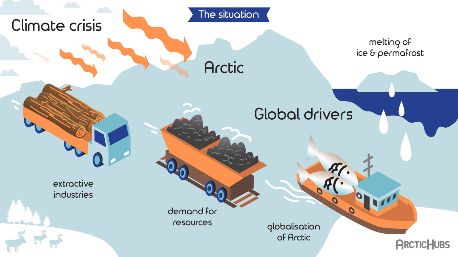
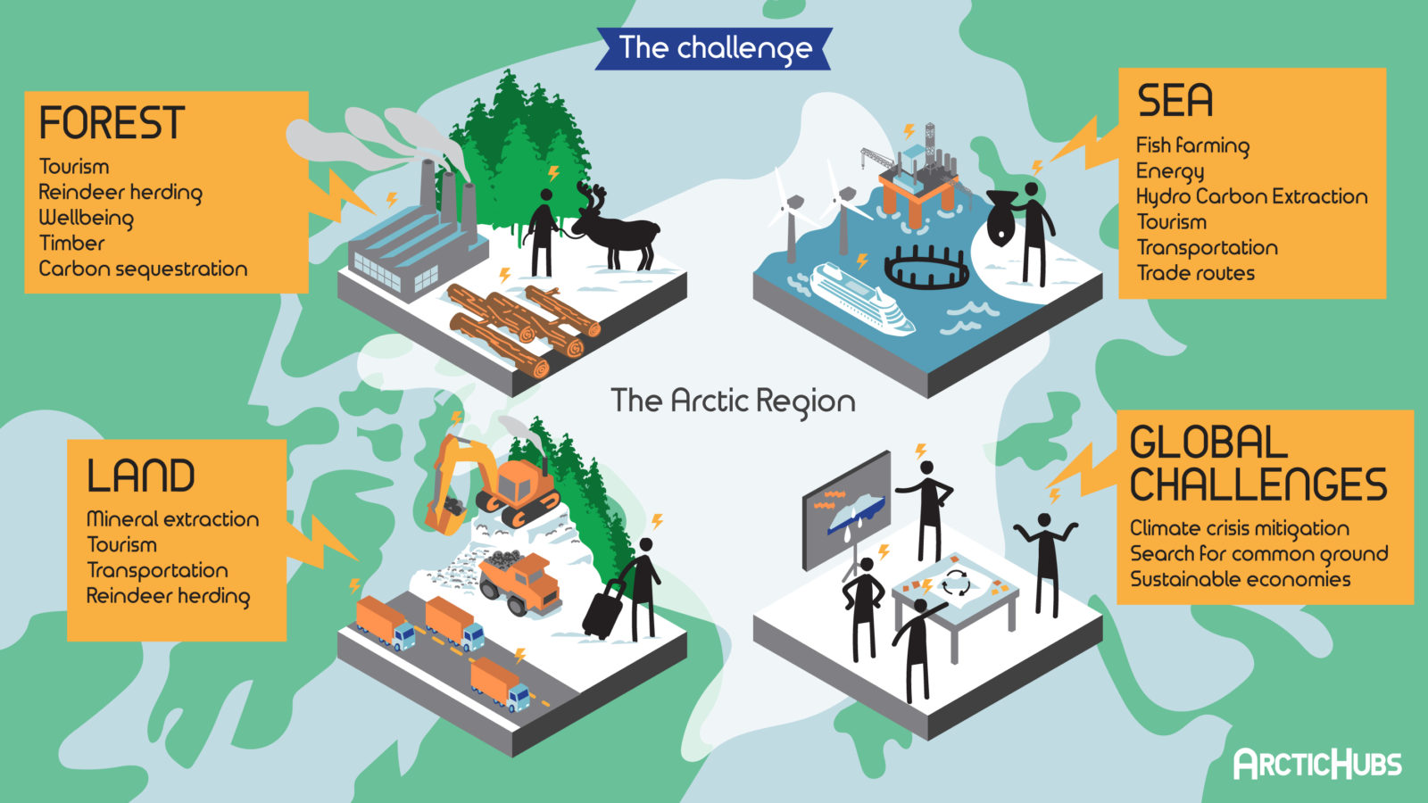
Climate change is projected to alter the Arctic more dramatically than any other region in the world. The Arctic today faces extraordinary pressures, with globalization and the climate crisis combining to drive change at an unprecedented rate. The opening up of new economic sectors, including mining and tourism, alongside the industrialization of many traditional livelihoods, such as fishing and forestry, are driving land use conflicts between competing sectors, and producing profound transformations on lives and communities at the economic, socio-cultural, political and environmental levels.
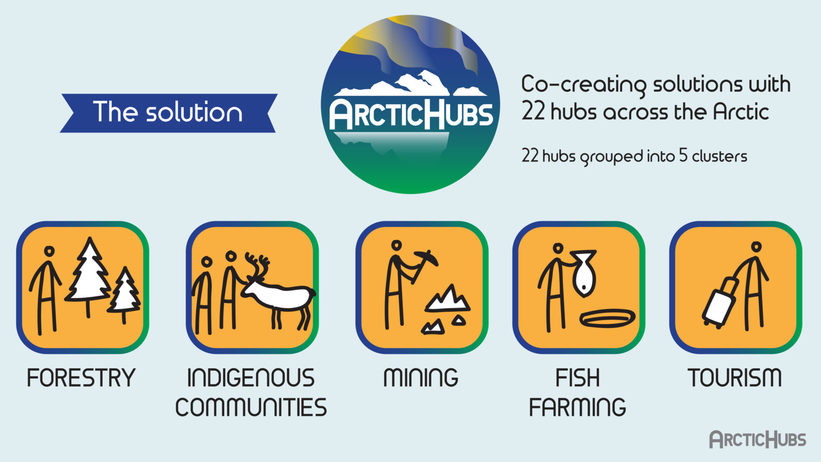
The ArcticHubs project is seeking to resolve conflicts over local resources and land through the use of new adaptive tools and approaches.
WHAT’S NEW?
The ArcticHubs webinar series Navigating the Future continues!
Arctic Futures 2035 – Opportunities and Threats
24th of May 13-14.30 CEST (14-15.30 Finnish time)
This webinar is based on the ArcticHubs working package 5, and it will be held in English.
Funded through the EU Horizon 2020 programme, ArcticHubs project has a core objective to develop research-led, practice-based solutions to help address the urgent challenges faced in the Arctic. The ArcticHubs project is seeking to move towards resolving conflicts over land and sea resources in the region notably by using new adaptive tools and approaches.
Foresight methods were used to enhance the ability of hub regions to adapt against future social, economic and environmental changes, in order to create more resilient communities. In the work package, future scenarios are being devised based upon a variety of data and collaborative methods used to incorporate local perspectives. These include statistical data, Delphi survey and future workshops in hub regions. Attention is placed in particular on crucial issues such as demographic changes, global interests in the Arctic, along with local and indigenous communities’ needs.
Our approach is truly participative, involving the gathering together of actors from different regional levels and different fields of life. Jointly we have developed different scenarios – evaluated the impacts of them – thought how to get to the desired future – and are building an associated suite of policy recommendations.
Here is the agenda:
24th of May 13-14.30 CEST
- Opening words and ArcticHubs presentation – Pasi RAUTIO
- Aims of future work – Seija TUULENTIE
- Foresight methods – Pasi RIKKONEN
- Results from each future work hub
- Iceland; Malå; Varanger; Faroes; Inari; Nuuk; Forestry; Arctic Youth; Future of different Arctic livelihoods
- Iceland; Malå; Varanger; Faroes; Inari; Nuuk; Forestry; Arctic Youth; Future of different Arctic livelihoods
- Open time for discussion
- Concluding words: What next? – Jonathan KARKUT
- Future forums, policy briefs

ArctiHubs Digital Game!
The ArcticHubs digital game emerged from the foundational stages of the ArcticHubs project.
The game offers a multifaceted platform for engaging with arctic issues, far beyond a mere conveyance of information.
Click on the link below to check its progress now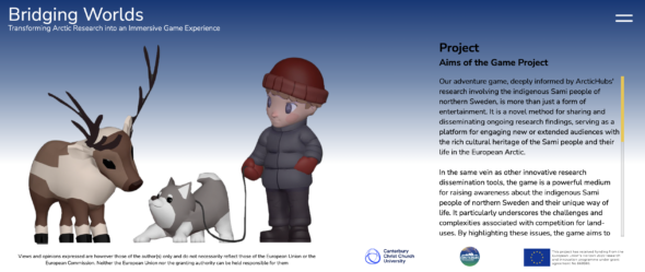
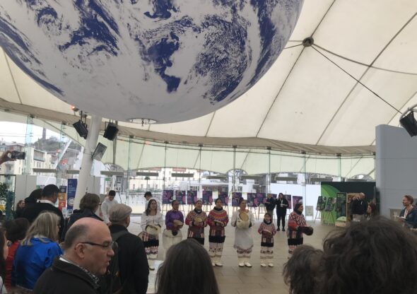
ArcticHubs sweeps into Scotland 🏴 with Arctic Science Summit Week 2024
Community engagement platform for data collection and conflict negotiation
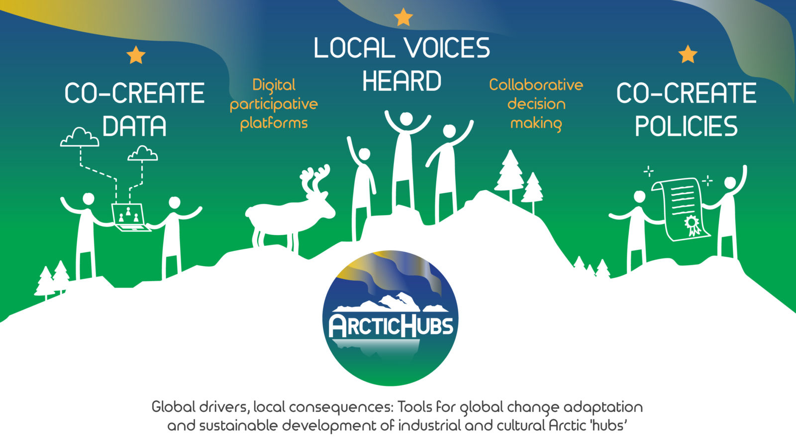
 The general aim of the ArcticHubs project is to explore ways to reconcile global industries with local livelihoods, as well as discover traditional and cultural ways of land use in the Arctic areas. As a part of this, the aim is to develop means for local citizens to participate in discussions and decision-making about land use in relation to different industries.
Development is made in selected areas, hubs which are important socioeconomic nodes representing various industries.
The advantages of Public Participation Geographic Information Systems
Geographic information systems-based participatory mapping methods such as Public Participation Geographic Information Systems (PPGIS), are increasingly used by decision-makers to improve the collection and utilisation of locally-relevant knowledge in decision-making and planning.
Read more on Innovation Newsnetwork
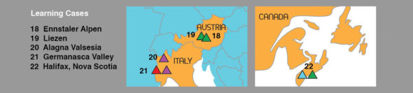
Last ArcticHubs General Assembly in Alagna Valsesia!
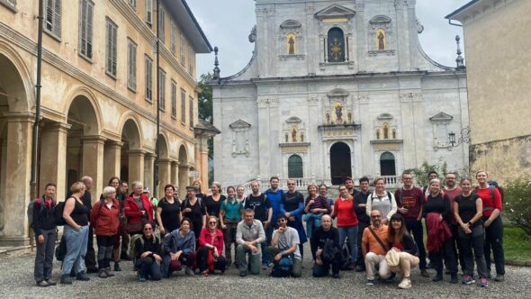
The ArcticHubs Consortium recently convened for its annual General Assembly in Alagna Valsesia, Italy. Hosted by the University of Turin, one of the key members of the project Consortium, this event held great significance as it focused on Alagna Valsesia Valley, a prime learning case for the ArcticHubs project.
This gathering served as a crucial milestone for the Consortium, uniting partner organizations and hub leaders from one of the project’s learning case areas.
Read more here.
Understanding Maptionnaire
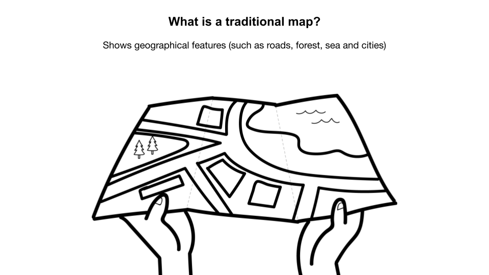
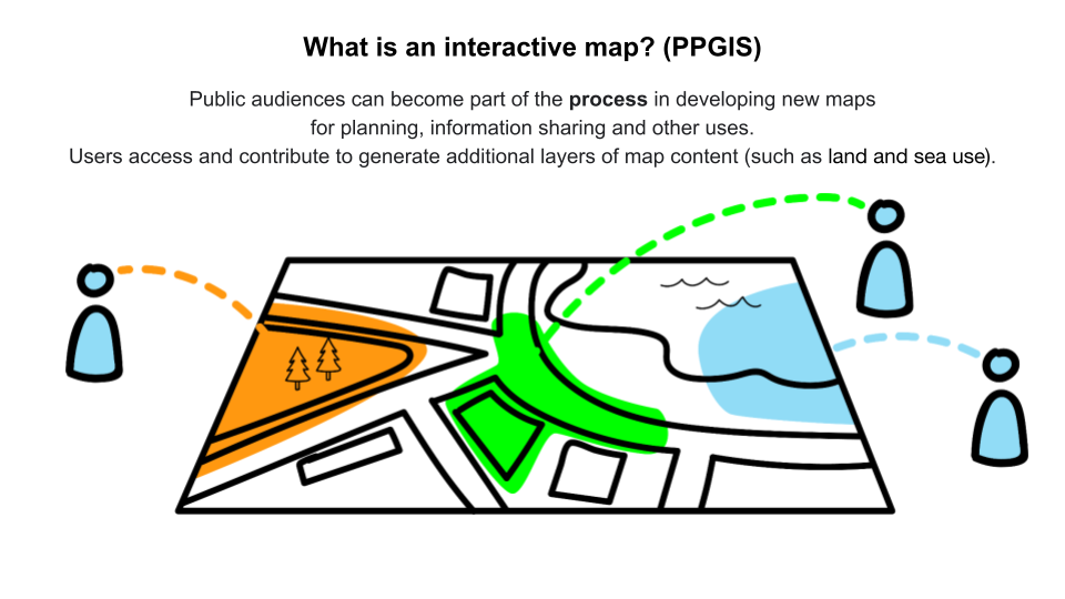
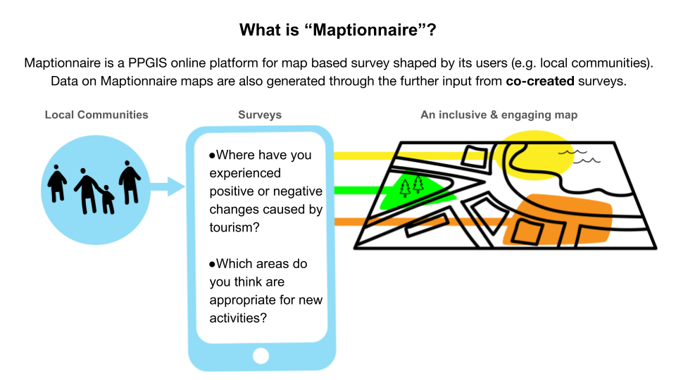
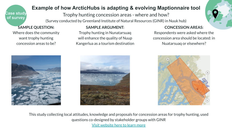
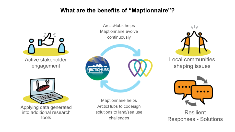
One effective approach to fostering collaboration and achieving sustainable use of land and water resources is through the collaborative design of solutions, involving local communities, researchers, stakeholders, policymakers, and local institutions. By actively involving these key stakeholders, we can ensure that the decisions made are inclusive, transparent, and aligned with the needs and aspirations of the community.
In this endeavor, Maptionnaire serves as a valuable tool for engaging the public and facilitating their participation in the process of generating additional layers of map content, such as land and sea use. Maptionnaire’s interactive map enables individuals to contribute their knowledge, perspectives, and ideas, thereby enriching the overall understanding of the area and fostering a sense of ownership among the stakeholders.
By leveraging Maptionnaire’s capabilities, we aim to create a collaborative environment where diverse voices are heard, enabling the co-creation of sustainable solutions for land and water resource management in the Arctic hubs.
ArcticHubs – How it works
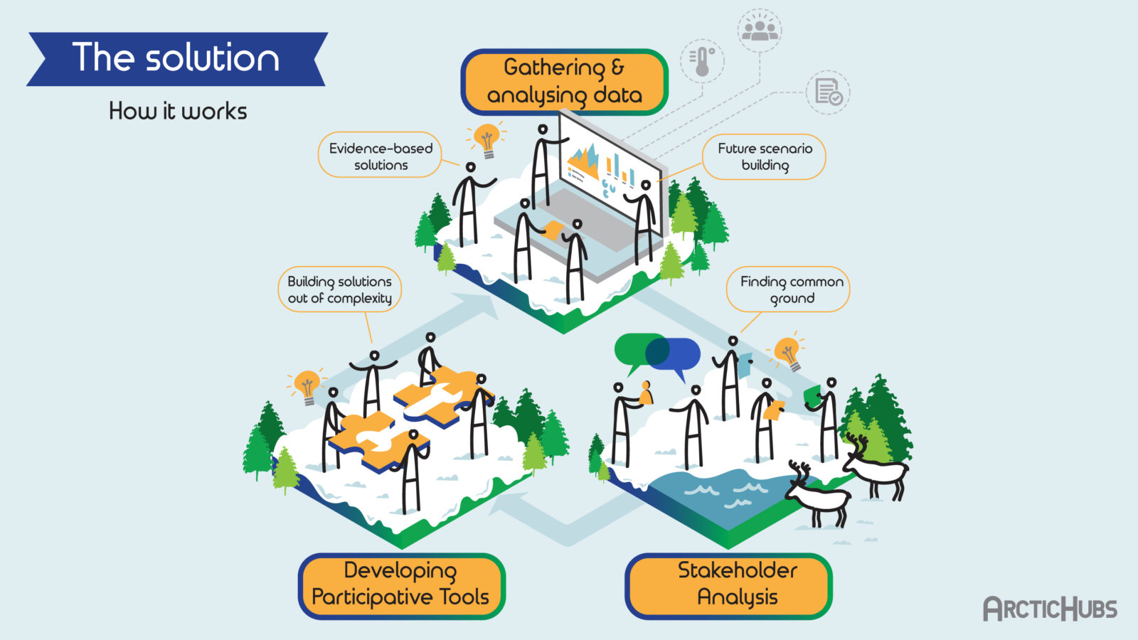
The ArcticHubs project is an ambitious, multi-disciplinary international collaboration that aims to develop research-led, practice-based solutions to help address the urgent challenges faced in the Arctic.
The project will work towards this goal through four specific objectives:
- Map and analyse global drivers influencing the future of the Arctic and explore how different kinds of global Actors in the region understand their social, economic and environmental responsibilities.
- Identify and quantify environmental, socioeconomic, cultural and political impacts of current industrial activities in the Arctic, and assess how predicted changes in activity resulting from adaptive responses to climate change will affect these impacts.
- Using a co-design approach, develop interactive tools for decision and policymakers to maximize uptake of knowledge of local situations and tensions, and to provide channels for continuous communication and dialogue with stakeholder groups.
- Using foresight methods, change the perspective from that of the present to the near future, with the aim of broadening consensus on developmental goals for the region.
Arctic hub locations
(click the coloured buttons to show individual hub types)
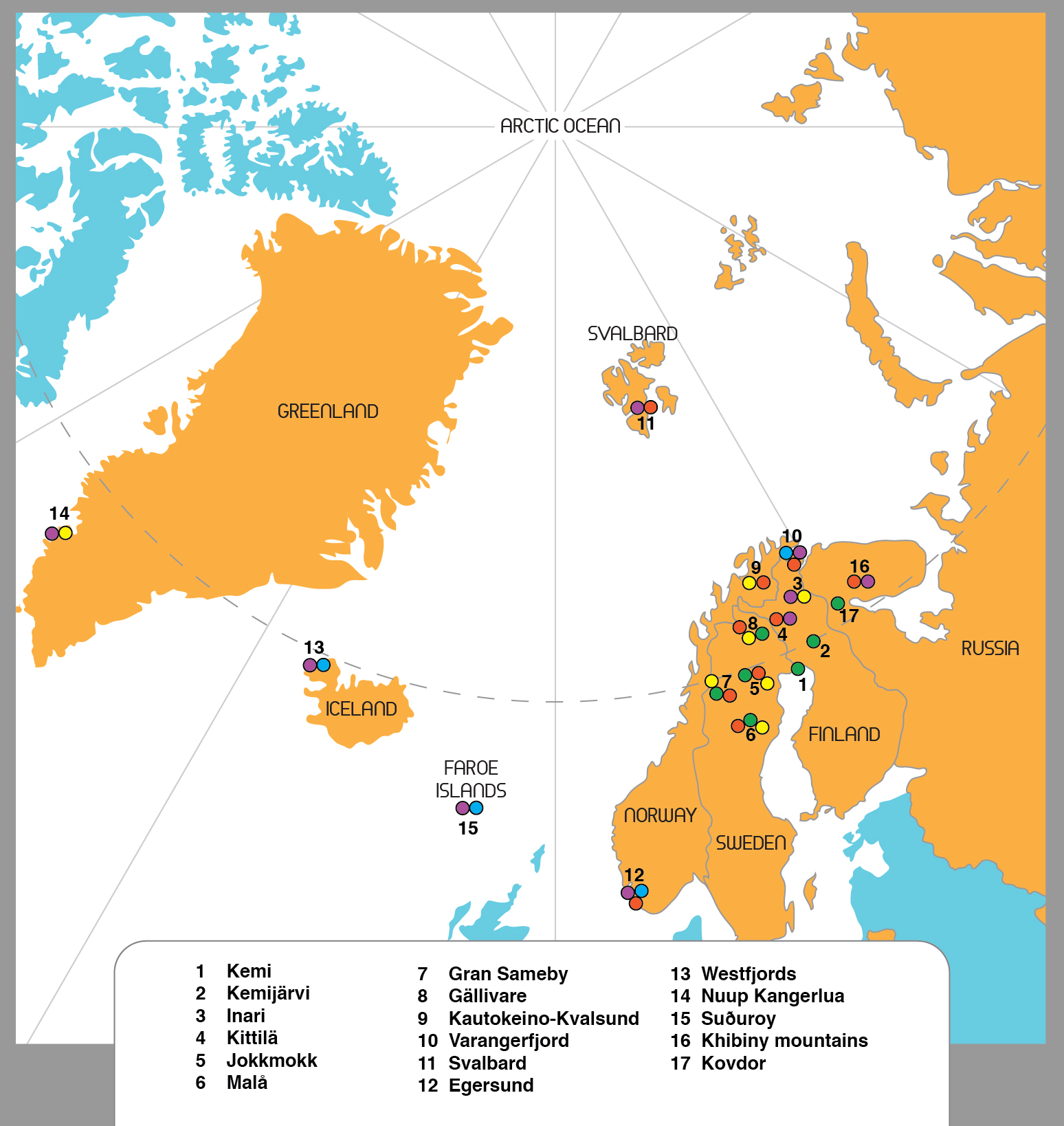
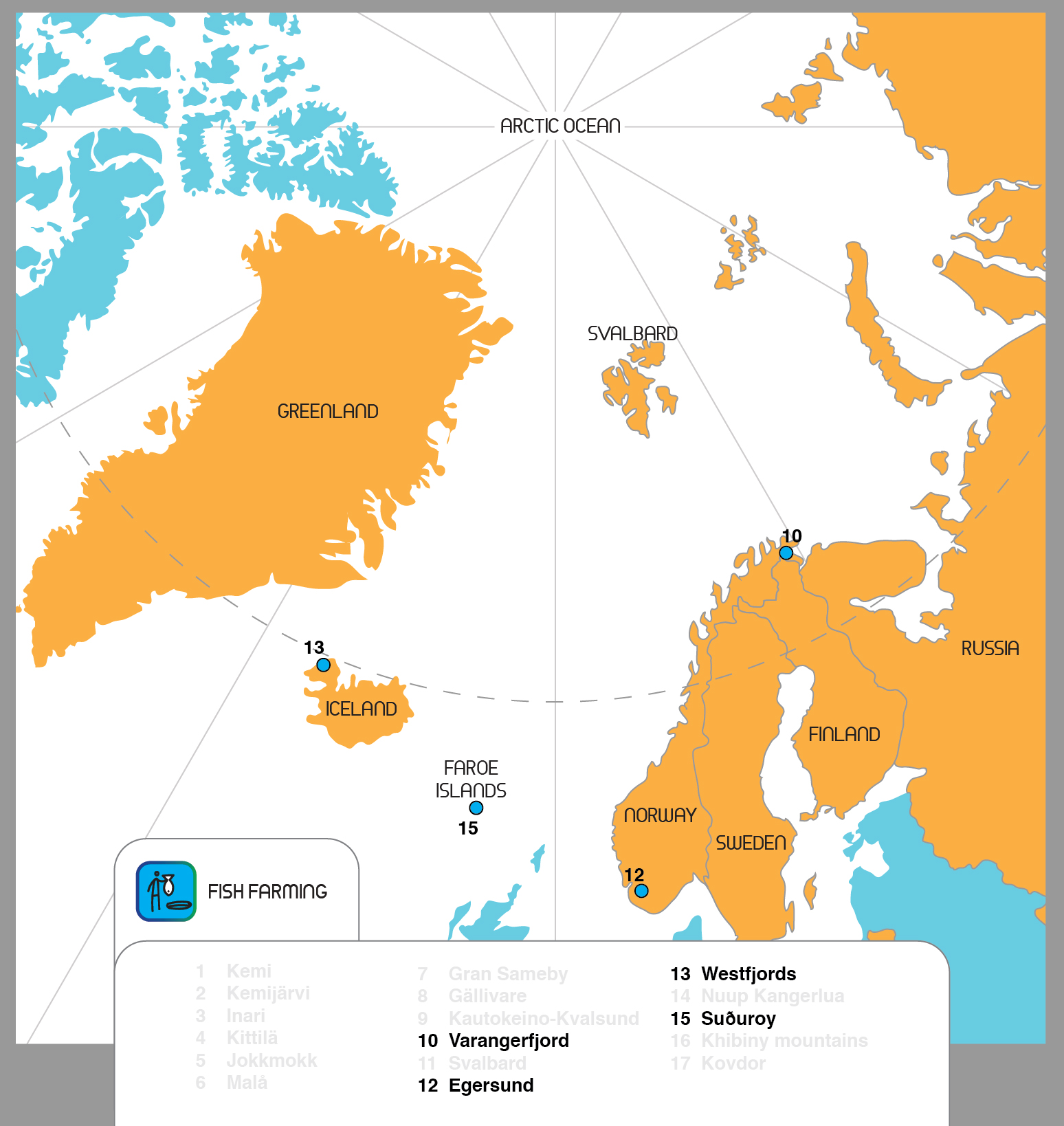
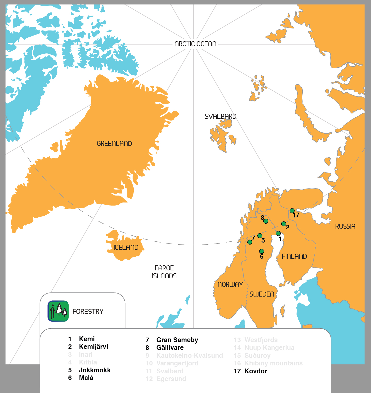
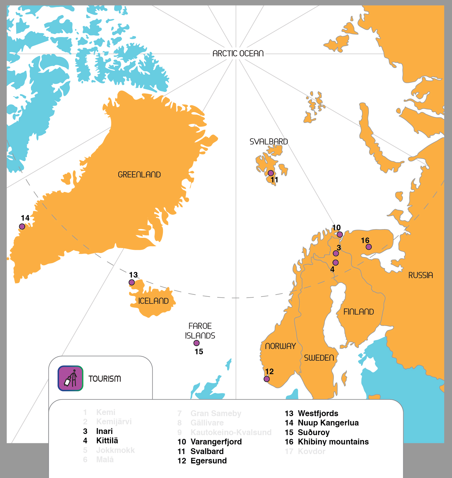
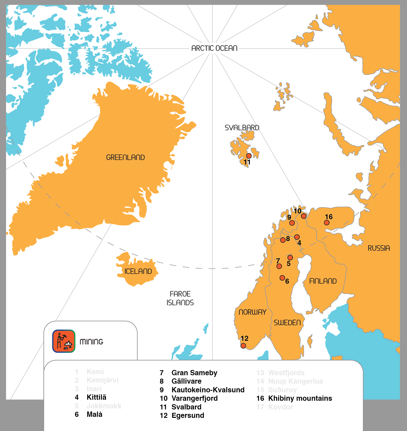
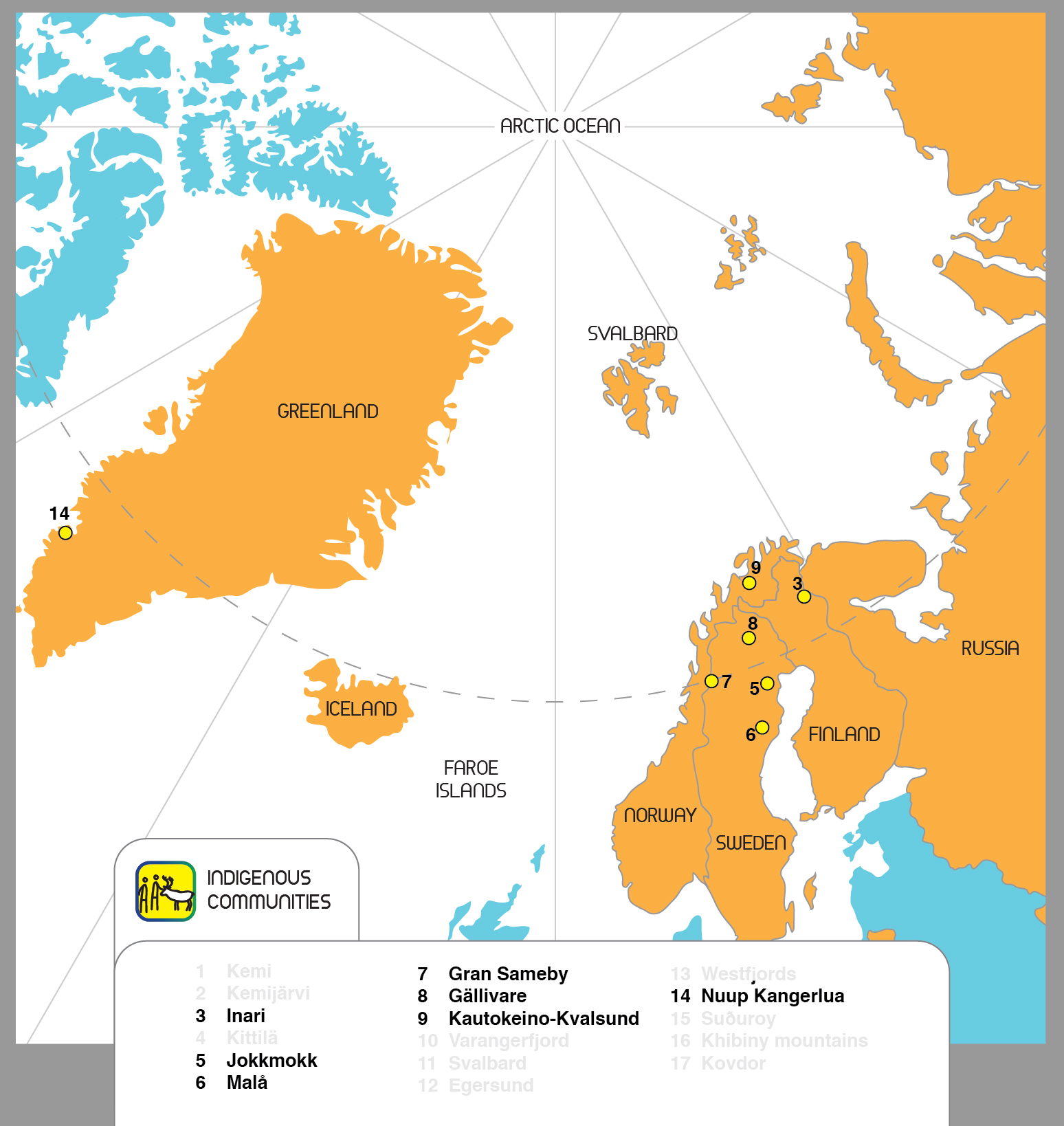
And Learning Cases