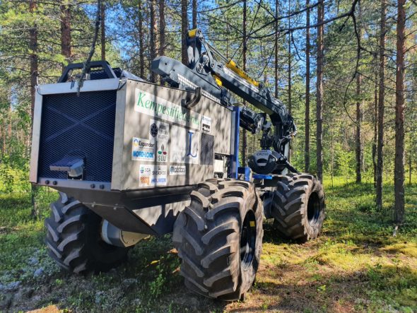
ArcticHubs researchers are drawing upon a range of innovative tools to find solutions to forest land-use conflict in the Arctic region: the Unmanned Forestry Machine (UFM), developed by some of the ArcticHubs partners, Luleå University of Technology in collaboration with Swedish University of Agricultural Sciences, is being tested as one of this in WP4 of the project activities.
Why is there a need of the UFM? And what is it?
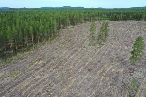
The interest conflict among different forest based eco system services (ESS) such as tourism, wood & paper production, recreation, carbon storage, reindeer husbandry, biodiversity, etc. is increasing.
The UFM is a mobile platform, unmanned, accommodating alternative sensors able to collect and process real time data on-site, from the forest environment. It enables rapid on-site collection of huge amounts of data on ESS areas.
According to Magnus Karlberg researcher at the Luleå University of Technology who is working at the development and testing of the machine:
“A UMF can be equipped with multiple sensors and enough processing capabilities to, based on global and local information, take decisions about forestry operations on-board and in real time enabling sustainable precise forestry planning management.”
During forest management activities, the human capabilities of collecting data on ESS while on-site and processing them, for a more accurate planning of the land-use and to avoid the conflict among the ESS, is very limited. Increasing the consideration to other ESS and plan according to ESS symbiosis is an important target for ArcticHubs. A solution requires extensive collection and real-time processing of data from the surrounding where multiple ESS activities are going on.
“In non-technical terms there are 3 key features of the machine that are relevant and these are that the machine is autonomous, enables full scale tests, it is reconfigurable” explains Magnus Karlberg.
In the current configuration the machine is able to collecting data from exteroceptive and proprioceptive sensors:
From exteroceptive sensors:
- 3D-stereo cameras to collect RGB and depth information which is used to detect obstacles, targets and to identify the local topology.
- Regular RGB-cameras for local planning purposes
- Lidar sensors giving ranges in discrete lines which is also used for local planning, obstacle and target detection.
- GNSS-sensor to give information about absolute position and heading
From proprioceptive sensors:
- sensors logging all relevant internal properties such as positions, pressures, velocities, accelerations etc. to at each given time know the machine state.
Increasing consideration to other ESS and planning according to ESS symbiosis are important targets for ArcticHubs. A solution to land-use conflicts requires extensive collection and real-time processing of data from the surrounding where multiple ESS activities are going on.
Information collected will be used in such a way to limit the damage and overlap among ESS activities. For instance,
Lichen damage during transport of wood can be limited while still enabling proper and precise soil preparation for wood material production or for seedlings, and with minimum soil disturbance, or habitats for sensitive species can improve and areas where relics is plausible to be found can be avoided and safe, etc., says Magnus Karlberg.