We recently had our partner Maptionnaire writing about us.
As the project’s goal is to find a way of designing solutions together with multiple stakeholders, it’s crucial to gather their opinions, as well as understand their practices of using the land, the sea, or other resources. Maptionnaire Community Engagement Platform is used as a data collection and conflict negotiation tool by the researchers, as well as a platform for communication and sharing information with locals and stakeholders.
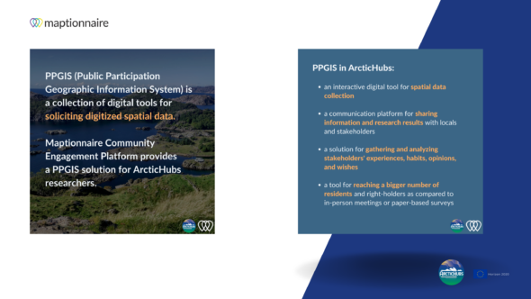
Maptionnaire is a PPGIS solution (Public Participation Geographic Information System) that gives a spatial dimension to experiences, habits, opinions, and wishes that participants submit through surveys made on this platform. Its digital form helps to reach out to a bigger number of residents and right-holders as compared to in-person meetings or paper-based surveys.
At the same time, being a part of the ArcticHubs project is also a development opportunity for Maptionnaire. The solution should develop more interactive functionalities — between the participants on the platform or between the researcher and respondents. Our team is working closely with researchers and listens to their needs to ensure that the PPGIS solution aids them with stakeholder engagement and data collection.
Maptionnaire for Stakeholder Engagement.
Read more here on Mapita’blog.